
New Doppler Radar Provides Research, Educational Opportunities to WIU Students
November 27, 2018
MACOMB, IL – Western Illinois University's Department of Earth, Atmospheric and Geographic Information Sciences will soon install a Doppler Radar on campus to provide more accurate regional weather information, as well as added research and educational opportunities for students.
The radar will be installed on top of Memorial Hall, to replace a current, non-functioning model. The hope is to have the new radar installed by April 2019, just in time for severe weather season.
The technology will be partially purchased by an estate gift from WIU Professor Emeritus John F. Blauvelt, who taught at Western for 45 years and passed away in 2016. It will be called the John F. Blauvelt Doppler Radar.
Money for the project was also donated by McDonough Power Cooperative in Macomb.
WIU Geography Professor Redina Finch said currently local residents get their radar information based on a radar that is a minimum of 70-80 miles from town. Because the radar beam has to travel so far, she said it is typically only reading the tops of local clouds.
"We are at a real disadvantage here," said Finch. "This will help fill that hole and help with earlier weather detection and better rainfall rates. We have had a few tornadoes in the area that were not warned or not warned enough ahead of time."
Finch said the images provided by the new radar will be available online for use by anyone.
"We want this to be an easy-to-use community service," she said. "It will be beneficial to farmers, power companies, first responders, television stations and others."
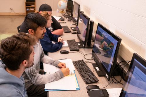
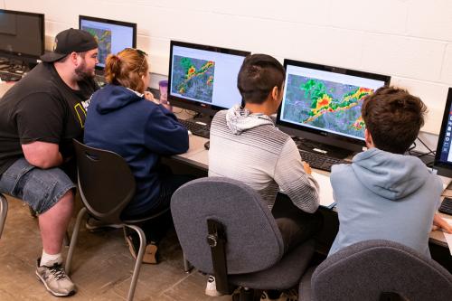
In terms of classroom uses, the radar will provide ongoing educational and research opportunities for WIU students. In recent years, students have been able to use a Doppler on Wheels, which is a high-resolution radar mounted on a truck. The unit is operated by the Center for Severe Weather Research in Boulder, CO, and was brought to campus in 2013 and 2015 after Finch wrote a grant proposal to the National Science Foundation.
Finch said she envisions the new radar being used by students in meteorology classes, but also in emergency management, law enforcement and justice administration and broadcasting classrooms as well. Students will also be involved in radar image interpretation and maintaining the website where the radar images will be available.
The existing radar had been on Memorial Hall for more than 40 years. After several technology upgrades, the unit was determined to no longer be useable.
The John F. Blauvelt Doppler Radar has several "bells and whistles" that can be added, including technology overlays that allow use with Geographic Information Systems (GIS) work and one that allows for detecting debris from a tornado. The new radar can also be controlled remotely so those involved with warning approaching storms do not have to come to campus to monitor the images.
"This will allow us to study individual storms and compare them to each other to learn more about which ones produce tornadoes and which ones don't," said Finch. "It will also allow students to learn to run the radar and interpret images."
The WIU Department of Earth, Atmospheric and Geographic Information Sciences is doing a fundraising campaign to pay for the radar's ongoing maintenance. To donate, visit bit.ly/FundWIUDoppler.
For more information about the WIU Department of Earth, Atmospheric and Geographic Information Sciences, visit wiu.edu/eagis.
Posted By: Jodi Pospeschil (JK-Pospeschil@wiu.edu)
Office of University Communications & Marketing
![[Download Print-Quality Image]](http://www.wiu.edu/images/news/15995/15995_8388_1.jpg)
![[Download Print-Quality Image]](http://www.wiu.edu/images/news/15995/15995_8389_1.jpg)
Connect with us: