
WIU GIS Center Works on Statewide Mandated Project
October 16, 2023
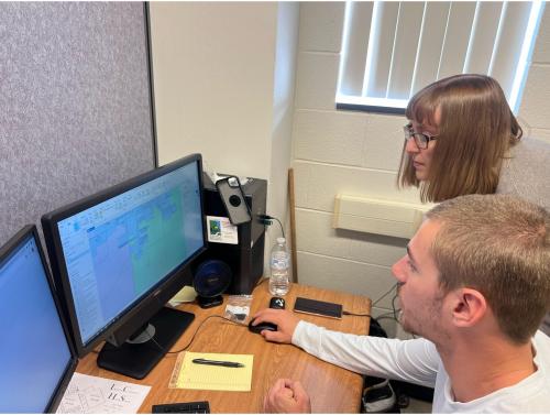
Sperry and his team collaborate with WIU undergraduate and graduate GIS students to ensure accurate geocoding of addresses and the state for emergency personnel and dispatch.
[Download Print-Quality Image]
![[Download Print-Quality Image]](http://www.wiu.edu/images/news/19488/19488_12466_1.jpg)
MACOMB/MOLINE, IL - - Chad Sperry, the director of the Geographic Information Systems (GIS) Center at Western Illinois University, was contacted by Cindy Cindy Barbera-Brelle, the Illinois Statewide 9-1-1 Administrator, to assist with a project aimed at meeting a statewide requirement for the implementation of the next generation of 911 technologies. Sperry was eager to take on the project.
"The WIU GIS Center has participated with the state of Illinois conversion to Next Generation 911 for over four years while assisting 20 counties and Public Safety Answering Points (PSAPs). Next Generation 911 uses GIS for multiple elements of functioning in a centralized environment. This project has afforded multiple students the opportunity to obtain hands-on experience that has led to job and internship opportunities, as well as unique learning opportunities. The involvement of the GIS Center has significantly contributed to the overall project, this includes staff members Renee Buker, megan Landes, Shawn Dooney, and Mark Warren - now retired. This project owes its roots in large to efforts from Chris Helle, Fulton County 911 Coordinator and Phil McCarty, West Central Joint ETSB Director. This project falls well within our mission to advance the development of GIS throughout Illinois," Sperry said.
The GIS Center at WIU, headed by Sperry, has opened this opportunity up for GIS students to participate in the milestone project for the last two years. Ten WIU undergraduate and graduate students have begun working alongside Sperry and his staff to geocode addresses and the state ensuring accuracy and representation for emergency personnel and dispatch. This allows quick access and efficacy when responding to all emergency situations. The project's focus is to centralize dispatching so that every call that comes through the state line will be routed through the same location. Currently, there are 138 public safety answering points for emergency dispatch.
"Engaging in the NG project has provided me with an opportunity to delve into a distinct facet of GIS, focused on bolstering safety measures and minimizing emergency response durations. Through this endeavor, I've gained proficiency in contemporary GIS technology for indoor mapping, significantly streamlining the ability of emergency teams to navigate critical situations within school environments. In a climate where incidents of mass shootings are on the rise, proficiently mapping building interiors stands as a pivotal means of safeguarding lives and swiftly responding to crises," said WIU GIS student Marcus Baptiste.
Geographic information systems (GIS) facilitate mapping and data layering for next-gen 911, enabling first responders to quickly locate calls and identify relevant agencies. This requires specialized software and partnerships between state coordinators and GIS organizations to establish standards and processes for data standardization.
"This has been a milestone project for the center in that we have been able to provide service for the residents of the state of Illinois and provide enhancements for public safety through the work and results of these projects," said Sperry.
Posted By: Lexi Dittmar (aj-dittmar@wiu.edu)
Office of University Communications & Marketing
Connect with us: